Becoming a key supplier of copper for the green energy revolution may be Zambia’s Government’s most ambitious goal. If achieved, the gains would be profound and far-reaching. First Quantum Minerals’ $1.25 billion investment in extending the life of Kansanshi Copper Mine brings with it the promise of more copper for the national inventory. Expansions at existing mines and new technology for obtaining deeper ores have important roles to play, and the S3 expansion at Kansanshi spells progress.
But one very important cog in mining’s growth engine still remains somewhat overlooked: mineral exploration. There’s a finite limit to the growth in copper production that can be achieved through existing mines. And, because we’re mining far more copper than we’re discovering, the goal of dramatically increasing copper production is still far from reach.
In our last article on mineral exploration, two geologists honed in on what “airborne geophysical data” is, and why Zambia needs a new national survey of the country. In this, the second instalment of our mineral exploration series, a top geologist and a seasoned mining engineer look at where we are today, and why mapping the country ought to be front and centre of Zambia’s mining policy.
Mapping Zambia is the top priority
“To this day, Government has not committed to conducting airborne surveys as a priority,” says Gilbert Temba, a mining engineer and former President of the Association of Zambian Mineral Exploration Companies (AZMEC), who headed up BHP Billiton Zambia – the Zambian subsidiary of the world’s largest Mining and Mineral Resources company – for five years of his long career. “Until Government commits to doing so, the goal of producing three million tonnes of finished copper production within a decade is nothing more than a pipe dream. Airborne surveys to stimulate and guide exploration are urgently required to stem the otherwise inevitable decline in Zambia’s copper production.”
“Until Government commits to conducting airborne surveys, the goal of producing three million tonnes of finished copper production within a decade is nothing more than a pipe dream.”
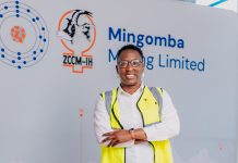
Alex Matthews, Secretary of AZMEC and Zambia Country Manager at KoBold Metals – an innovative exploration firm that recently announced an investment of $150 million to further explore copper resources around Zambia’s Mingoma deposit – agrees that a production slowdown is likely in the medium term, unless work to map the country begins imminently. “It’s important to remember that, with mining, your asset base reduces every time you haul a truck of ore.”
He says that Zambia needs far more “discovery and delineation”. (“Delineation” is calculating and proving that a mineral resource exists, rather than just inferring that it’s there.)
“In order to do that, we need to get better at doing it, as a sector. How do we get better at it? We have to be braver and to drill more holes. That requires more money. We’ve also got to get better at applying our knowledge of exploration geoscience. But to help us get there, we also need to have much more freely available data.”
That’s where the national airborne survey comes in. Mr Matthews strongly believes that, once conducted, Government must make the geophysical data that is obtained free for anyone to use.
Why should valuable data like this be freely available?
“Free data is a great leveller,” says Mr Matthews. “If it’s available to everyone for free, that can only be good for dynamic young companies, explorers and geologists.” Providing prospectors and investors with data encourages them to do the exploration drilling (at great expense) that leads to mineral discoveries in the first place. And, when a mineral discovery is substantial enough, that’s when new mines are built.
The way that Mr Temba sees it, the roles are clearly demarcated: governments conduct the airborne surveys and private companies handle the exploration drilling. “The information obtained from an airborne survey is owned by the government. When investors look at a map of Zambia, they can see which areas have different types of mineralisation. It doesn’t tell you the percentage of any one mineral, and it doesn’t tell you precisely where these reserves are. But the information is sufficient for a mining company to decide which area to drill in, whether they’re drilling to establish the presence of copper or gold or diamonds…”
Being overly protective about geophysical data doesn’t serve anyone, these geologists insist. Free access to this data is not like handing somebody the keys to a copper mine. Rather, it’s providing the future miners of the country’s minerals the motivation to get started in the first place. “Ultimately, we need what we call a ‘truth machine’ – and that’s a driller,” says Mr Matthews. “Until we actually go and drill a hole in that particular location, we cannot prove a mineral resource’s existence.”
“Free access to this data is not like handing somebody the keys to a copper mine. Rather, it’s providing the future miners of the country’s minerals the motivation to get started in the first place.”
Who is going to fund a national geophysical survey?
Groups like the World Bank and the European Union have expressed willingness to help Zambia to pay for this kind of airborne exploration, says Mr Temba. Why the willingness? Airborne geophysics is viewed as a “tool to promote mineral investment in Africa”, and international funding agencies such as the World Bank, European Community and African Development Bank support their creation because research shows that, in jurisdictions across the world, “high-quality geophysical coverage leads directly to increased and more focused exploration.” In other words, up-to-date surveys attract new investment in the mining sector, which spurs economic development.
Good quality geoscientific data can also be used for many different purposes, from environmental monitoring, to agriculture, to hazard analysis, says Mr Matthews. “There are so many different applications for data like this, and it’s all really important for governance – and for economic development.”
There is evidence right across the border. A recently-conducted national airborne survey of every inch of Namibia has helped to boost mineral exploration and encouraged investment in the country. “Mozambique is also 100 percent mapped,” says Mr Temba, adding that sometimes governments engage private companies to conduct airborne surveys at great cost, but both Namibia and Mozambique utilised external funding. “Yet only 50 percent of Zambia has been surveyed – and most of the areas surveyed are in North-Western province and Copperbelt Province,” he added. “The other half of the country has never been touched!”
“A recently-conducted national airborne survey of every inch of Namibia has helped to boost mineral exploration and encouraged investment in the country. “Yet only 50 percent of Zambia has been surveyed!”
Recent but very sporadic mineral discoveries – such as the find announced in December 2022 which convinced KoBold to invest in an exploration program – illustrate just how little we know about the natural resources that lie beneath Zambia’s surface. Incentivising existing mines to produce more copper or nickel – or any mineral – is important, and Mr Temba believes that the 2023 Budget’s mineral royalty taxation measures will do just that.
But existing mines can only do so much. Even if capital injections enabled current operations to produce around 400,000 additional tonnes a year (an optimistic estimate that might be achievable if approximately $4.3 billion is invested), annual production would still fall short of 1.5 million tonnes. There’s no getting around the fact that many new mines – and many more bold explorers with deep pockets – will be needed to help the country inch closer to its ambitious production goals.
***
In the next instalment of Mining For Zambia’s Mineral Exploration series, we look at the latest developments in the exploration space – including KoBold’s exciting new find at Mingoma – and ask the country’s top geologists and mining engineers how Zambia can attract the explorers that will find the next generation of mines.
Look out for it on our website or social media platforms, or simply send your address to info@miningforzambia.com to receive an email the minute it’s published. You can also use the ‘mineral exploration’ tag (below) to locate the series any time.
See also: Mapping the minerals of the future


